Land Subsidence
- Home
- Groundwater Sustainability
- Land Subsidence
The USGS has reported that groundwater pumping resulting from severe drought conditions in the San Joaquin Valley has led to renewed subsidence of several feet (USGS, 2013). This subsidence has the potential to cause serious damage to facilities in some areas. The cause of the subsidence is the dewatering and subsequent compaction of clay and silt deposits within the groundwater aquifer. However, this subsidence is not occurring everywhere, particularly on the Kern Water Bank.
Subsidence on the Water Bank has been independently monitored by the Department of Water Resources since June of 1994, several years before any recovery operations occurred. Since that time, the land surface has simply moved up and down a few inches. (Figure 1). The lack of subsidence can be attributed to the significant volumes of water the KWB has recharged – far more than it has recovered – and the fact that the aquifer underlying KWB lands does not contain significant volumes of the sediments that are susceptible to compaction upon dewatering.
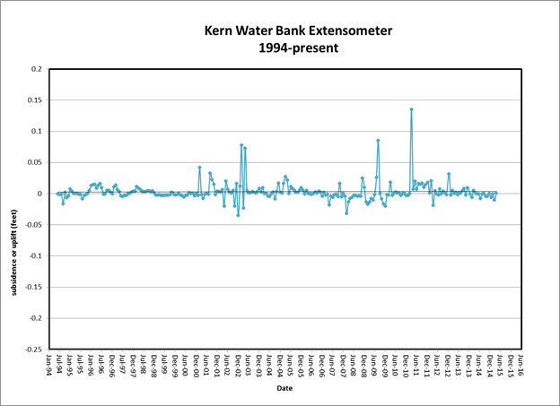
Figure 1. Changes in land surface elevation as measured in an extensometer in well T30S/R25E-16L1.